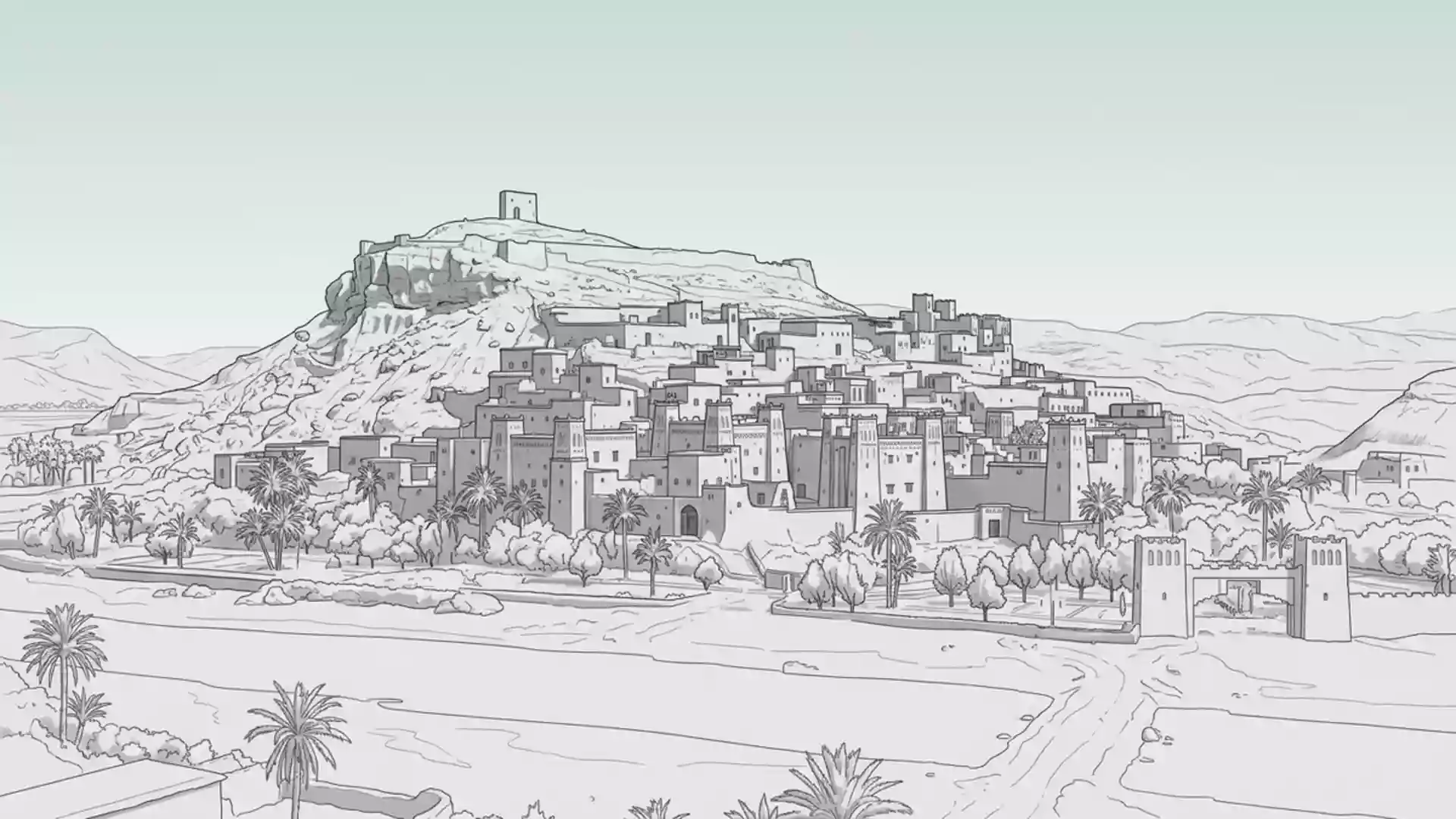
Ait Ben Haddou: an earthen ksar above the Ounila Valley
Published on 09/03/2026 at 20:37 | Editorial responsibility: Rafael Müller, Editor-in-Chief AD HOC NEWS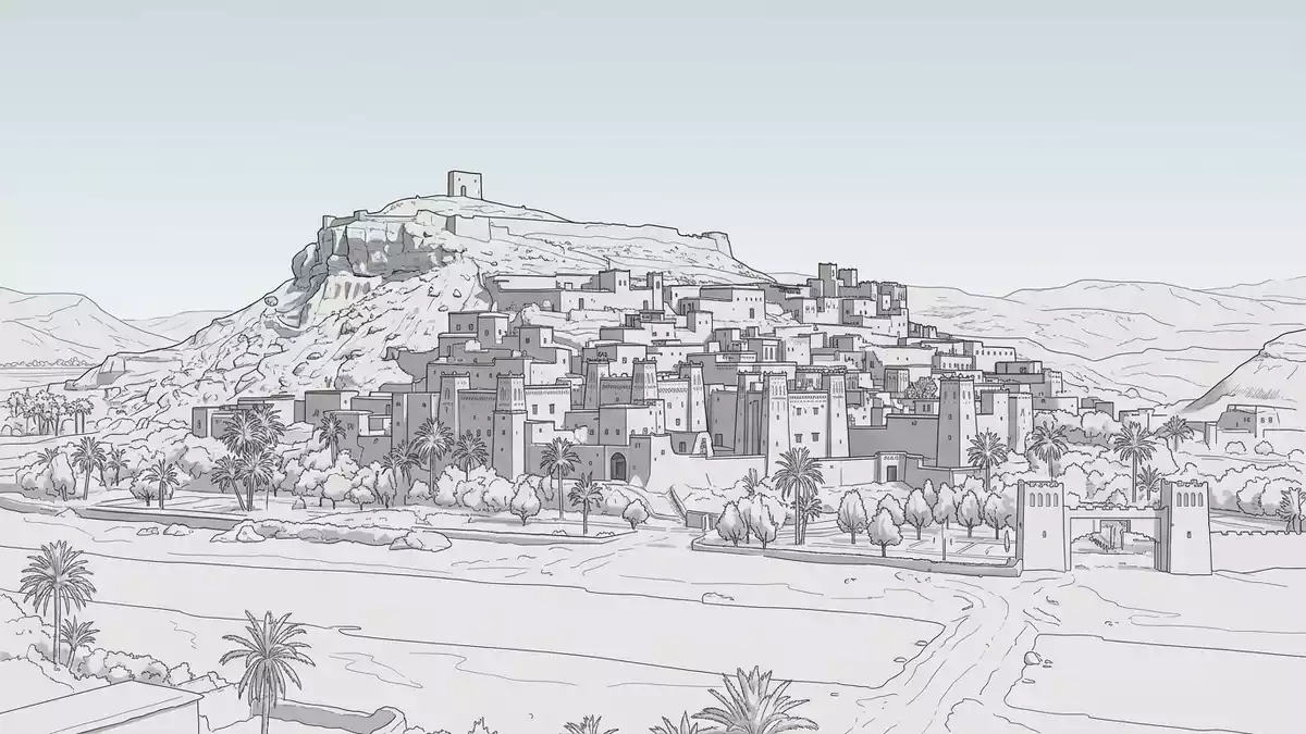
Ait Ben Haddou is a historic fortified ksar on the southern slopes of the High Atlas Mountains in Morocco, where earthen towers rise above the Ounila Valley near Ouarzazate. This traditional settlement of clustered mud-brick houses within defensive walls is inscribed as a UNESCO World Heritage Site, recognising its role along the former caravan route between the Sahara and Marrakech and its characteristic clay architecture dating largely from the seventeenth century.
An earthen fortress village on the High Atlas slopes
Ait Ben Haddou stands in Ouarzazate Province in southern Morocco, on the west bank of the Ounila River in the foothills of the High Atlas range. The ksar occupies a hillside above the valley, with its compact mass of houses and towers rising in tiers from the river bank to a small fortification at the summit.southern slopes of the High Atlas The settlement’s position along a historic caravan corridor linking the Sahara to Marrakech made it an important stopping point for traders moving goods such as salt and gold across the desert.former caravan route between the Sahara and Marrakesh
The core of the ksar consists of houses built from packed earth and mud plaster, arranged inside high defensive walls reinforced by corner towers. Within these walls stand communal structures including a mosque, a public square and threshing areas, while outside lie cemeteries that reflect the mixed religious history of the community.group of houses inside high defensive walls The reddish earthen material used for the walls and towers gives Ait Ben Haddou its distinctive colour, blending the architecture into the surrounding valley slopes.
From Almoravid fortification to UNESCO World Heritage site
Settlement at Ait Ben Haddou is associated with the Almoravid period in the eleventh century, when the site was fortified during the rise of this Berber dynasty in Morocco.fortified from the eleventh century during the Almoravid period Archaeological and historical studies indicate that while the hilltop location and defensive function date back many centuries, most of the visible buildings belong to the seventeenth century and later, built with techniques established long before.none of the buildings earlier than the seventeenth century
The Ksar of Ait Ben Haddou was inscribed on the UNESCO World Heritage List in 1987 for its earthen architecture and its role in trans-Saharan trade networks.inscribed on the UNESCO World Heritage List in 1987 UNESCO highlights the settlement as an outstanding example of a pre-Saharan habitat, where traditional construction methods use local clay mixed with organic materials to form thick walls that are periodically repaired. The layout, with its single baffle gate, surrounding ramparts and hilltop fort, reflects the need for defence along trading routes exposed to raids and conflict.fortified tribal village dating from the seventeenth century
Walking through clay lanes and stacked towers
Approaching Ait Ben Haddou from the modern village on the opposite bank, visitors cross the river and make their way up through gateways into the ksar, where narrow lanes wind between blank earthen facades. As the path climbs the hillside, stacked houses give way to taller towers whose upper levels command views over the valley and the High Atlas ridges beyond.rises from the Ounila Valley in the High Atlas foothills Within the walls, some former houses have been restored, their interiors showing the structure of rooms arranged around small courtyards and lit by modest openings in the thick walls.
The climb to the hilltop fort leads over uneven earthen steps and through sloping passages, revealing how the settlement’s tiers follow the shape of the slope. From the upper terraces, the view takes in the ribbon of the Ounila River, the cultivated valley floor and the contrasting mass of the ksar’s towers. The combination of defensive walls, communal spaces and stacked clay dwellings gives Ait Ben Haddou a distinctive silhouette that has become closely associated with southern Moroccan earthen architecture.example of southern Moroccan earthen architecture
Visiting Ait Ben Haddou: what travellers from Western Europe should know
- Ait Ben Haddou lies north-west of Ouarzazate in southern Morocco, reached by road that follows the Ounila Valley through the High Atlas foothills from the regional centre.
- Inside the ksar, movement involves climbing sloping paths and uneven earthen steps on the hillside, as well as crossing narrow lanes between mud-brick walls.
- The surrounding landscape is semi-arid, with the clay structures and valley slopes exposed to sun and occasional strong winds characteristic of the High Atlas edge.
- The official language is Arabic and the currency is the Moroccan dirham.
- Entry requirements depend on your nationality; UK travellers can check the FCDO travel advice at gov.uk/foreign-travel-advice, Irish travellers the Department of Foreign Affairs at ireland.ie.
Searching for Ait Ben Haddou on social platforms
These links open searches for Ait Ben Haddou on each platform.
Frequently asked questions about Ait Ben Haddou
Where is Ait Ben Haddou located in Morocco?
Ait Ben Haddou is in Ouarzazate Province in southern Morocco, on the southern slopes of the High Atlas Mountains above the Ounila Valley north-west of Ouarzazate.
What should visitors expect when walking through the ksar?
Visitors encounter narrow earthen lanes, sloping paths and steps on the hillside, passing mud-brick houses and towers within defensive walls that climb from the river bank towards a hilltop fort.
What makes Ait Ben Haddou distinctive among Moroccan heritage sites?
Ait Ben Haddou is distinctive for its seventeenth-century earthen architecture within fortified walls, its Almoravid-era origins as a caravan stop and its UNESCO World Heritage status as a pre-Saharan ksar.