
Bay of Fundy and the shoreline rewritten by the tide
Published on 09/24/2026 at 03:00 | Editorial responsibility: Rafael Müller, Editor-in-Chief AD HOC NEWS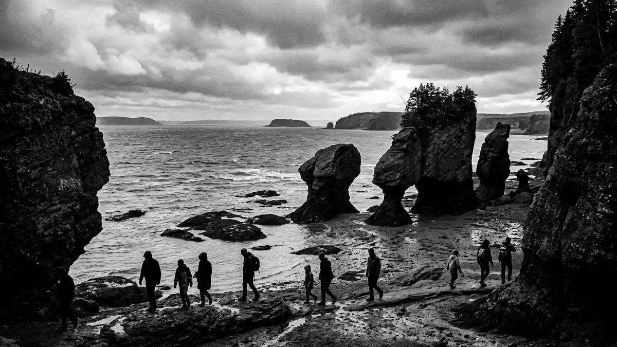
Bay of Fundy is an Atlantic inlet between New Brunswick and Nova Scotia, extending inland from the Gulf of Maine. Its shoreline changes dramatically as the tide rises and falls, bringing the sea into direct contact with cliffs, mudflats, river channels and exposed seabed.
A bay measured by the movement of water
The bay stretches for roughly 270 km (168 miles) and reaches about 16,000 square kilometres in area. Its funnel-shaped outline narrows towards the upper bay, while depths reach approximately 200 metres. These physical proportions are closely matched to the Atlantic tidal cycle, producing an exceptionally large change between low and high water.
The tidal range reaches about 16 metres (52 ft) along parts of the bay, though the exact figure varies between locations. At Fundy National Park, the water level can rise by 12 metres or more during a tidal cycle. the bay’s tidal range is also visible in the channels and shorelines around Saint John.
Saint John where river and sea meet
Saint John lies at the mouth of the Saint John River, where freshwater reaches the Bay of Fundy. The city’s Reversing Rapids form in a rocky gorge near the river mouth, with rapids and whirlpools appearing as the river and tide interact.
At low tide, the river runs towards the bay. Rising seawater slows that flow, creating a short interval known as slack tide, before the direction of the river current changes. The Reversing Rapids can be viewed from lookout points near Fallsview Park and Wolastoq Park.
Cliffs, forests and a geological record
The coast combines sandstone, mudflats, salt marshes, coves and steep cliffs. Erosion exposes layers from different stages of geological history, including rock associated with the Cobequid Fault and the assembly and breakup of Pangaea.
Fundy National Park was established in 1948 on New Brunswick’s coast. It protects Acadian forest, river valleys, freshwater lakes, waterfalls and a section of the Fundy coastline. Fundy National Park lies near Alma and is linked with the wider Fundy Biosphere Region.
The Stonehammer UNESCO Global Geopark extends across part of southern New Brunswick, including geological landscapes around Saint John. On the Nova Scotian shore, the Cliffs of Fundy UNESCO Global Geopark presents cliffs and rock layers shaped by the bay’s tides. The Cliffs of Fundy preserve geological evidence spanning hundreds of millions of years.
Visiting Bay of Fundy: what travellers from Western Europe should know
- Bay of Fundy reaches Saint John on New Brunswick’s southern coast. Saint John Airport serves the city, while highways connect Saint John with Fundy National Park and the communities along the coast.
- The shoreline includes steep cliffs, slippery intertidal rock, mudflats and river gorges. At low tide, parts of the seabed become accessible, but the rising water changes the coastal landscape.
- Fundy National Park lies near Alma and includes Acadian forest, freshwater lakes, waterfalls and the coast of Chignecto Bay.
- The official language is English and French, and the currency is the Canadian dollar.
Searching for Bay of Fundy on social platforms
These links open searches for Bay of Fundy on each platform.
Frequently asked questions about Bay of Fundy
Where is Bay of Fundy?
Bay of Fundy lies between New Brunswick and Nova Scotia on Canada’s Atlantic coast. Saint John stands at the mouth of the Saint John River on the bay’s western side.
What can visitors expect to see?
Visitors encounter cliffs, forests, rapids, mudflats, salt marshes and exposed seabed. Fundy National Park adds waterfalls, lakes and Acadian woodland to the coastal landscape.
What makes Bay of Fundy distinctive?
The bay has an exceptionally large tidal range, reaching about 16 metres (52 ft) in parts of the coastline. Around Saint John, the changing tide interacts with the Saint John River at the Reversing Rapids.


