
Caminito del Rey follows the walls of a limestone gorge
Published on 09/24/2026 at 00:31 | Editorial responsibility: Rafael Müller, Editor-in-Chief AD HOC NEWS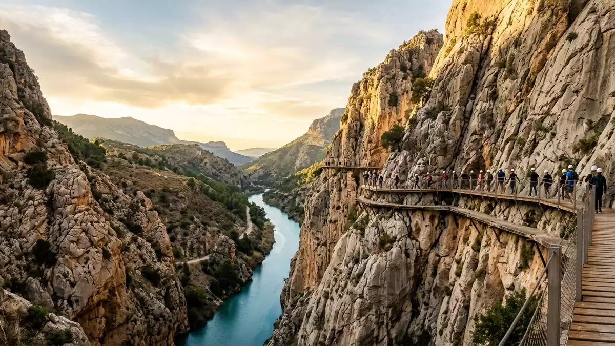
Caminito del Rey is a suspended walkway in the Desfiladero de los Gaitanes near Ardales, Málaga. Its route follows limestone walls above the Guadalhorce, combining a narrow gorge with the remains of an early twentieth-century hydroelectric landscape.
A walkway above the Guadalhorce
The path runs through a gorge cut into limestone by the Río Guadalhorce. The walls rise sharply around the route, while the river, reservoirs and power infrastructure appear at different levels below and beside the walkway.
Sections of the route pass directly against the rock face. Other sections cross open gaps on a raised passage, creating a continuous line between the Gaitanejo and El Chorro areas. The gorge reaches around 300 m in height and narrows to less than 10 m in places.
From hydroelectric access to a named route
The original walkway formed part of the infrastructure serving the Gaitanejo and El Chorro hydroelectric stations. Construction began in 1901 and concluded in 1905, with the path providing access through the difficult terrain between the installations. Construction history
King Alfonso XIII crossed the route in 1921 during the inauguration of the Conde de Guadalhorce dam. The name Caminito del Rey dates from that royal connection. The route therefore carries both an engineering history and a geographical identity tied to the Gaitanes gorge.
Rock, water and a suspended passage
The Desfiladero de los Gaitanes gives the walkway its defining setting. Limestone and Jurassic dolostone form the gorge, whose steep faces rise above the Guadalhorce basin. The narrow rock corridor contains dams, tunnels, channels and bridges linked with water management.
The route reaches around 100 m above the river in places. Its modern passage includes a raised boardwalk fixed along the cliff, while older remnants remain visible beside sections of the route. The elevated walkway follows the gorge between the Gaitanejo and El Chorro waterfalls.
The surrounding landscape combines exposed rock with Mediterranean vegetation. Birds occupy the cliffs, and the changing width of the gorge creates a sequence of open views, enclosed passages and elevated crossings. The route is a built line within a natural formation, not a separate attraction detached from the river valley.
Visiting Caminito del Rey: what travellers from Western Europe should know
- Caminito del Rey lies in Málaga province, between Ardales and Álora. The route is reached by road and rail connections serving El Chorro, with the A-357 providing access from the Málaga area.
- The walk includes cliffside boardwalks, bridges, tunnels, stairs and exposed sections above the Guadalhorce. The route requires walking on uneven ground and crossing elevated passages.
- The Desfiladero de los Gaitanes is a limestone gorge with steep walls, reservoirs and hydroelectric structures. The landscape changes from narrow rock corridors to open views across the river valley.
- The official language is Spanish and the currency is the euro.
Searching for Caminito del Rey on social platforms
These links open searches for Caminito del Rey on each platform.
Frequently asked questions about Caminito del Rey
Where is Caminito del Rey?
Caminito del Rey is in the Desfiladero de los Gaitanes in Málaga province, near Ardales and Álora. The route follows the Guadalhorce gorge between the Gaitanejo and El Chorro areas.
What does the route contain?
The route contains cliffside boardwalks, bridges, stairs, tunnels and elevated crossings. Limestone walls, reservoirs and hydroelectric structures form the surrounding landscape.
What makes Caminito del Rey distinctive?
The walkway combines a suspended path with an industrial history dating from 1901 to 1905. Its royal name comes from Alfonso XIII’s crossing in 1921.


