
Canal Beagle, where Ushuaia meets the sea and the Andes
Published on 09/01/2026 at 14:35 | Editorial responsibility: Rafael Müller, Editor-in-Chief AD HOC NEWS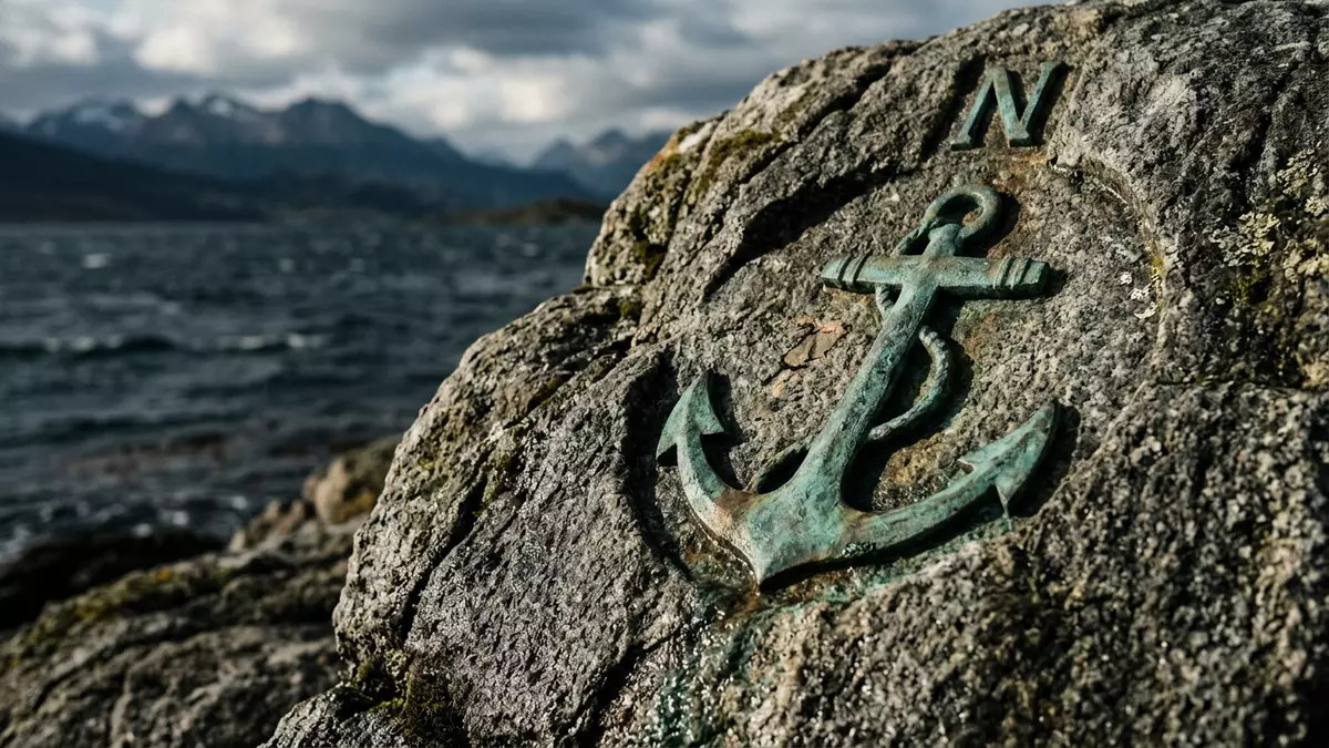
At Ushuaia in southern Argentina, Canal Beagle — the Spanish name for the Beagle Channel — draws a narrow ribbon of sea between the Andes and a scatter of islands at the tip of South America. This strait runs broadly east–west through the Tierra del Fuego archipelago, with Ushuaia as its largest settlement and a working port facing the water. For travellers, it is an accessible way to stand in a landscape where mountains, sea and the idea of “the end of the world” converge in a single view.
A narrow strait in the Tierra del Fuego archipelago
Canal Beagle is a strait in the wider Tierra del Fuego archipelago at the southern tip of South America, separating the main island of Tierra del Fuego to the north from Navarino, Hoste and other islands to the south.strait in the Tierra del Fuego archipelago The channel trends broadly east–west and stretches for roughly 240 km (about 150 miles), forming part of the border between Argentina and Chile in its eastern section.240 km long and forms part of the border
To the north of the waterway lies the main island of Tierra del Fuego, with its continuation of the Andes running down toward the sea, while to the south sit Navarino, Hoste and smaller islands that give the strait its broken, intricate coastline.separates the main island from Navarino and Hoste The western reaches of Canal Beagle branch around Isla Gordon, before the strait opens toward channels that lead toward the Pacific. In its eastern sector, the frontier between Argentina and Chile follows the middle of the channel, with Argentine territory on the northern shore and Chilean territory to the south.border between Argentina and Chile runs along the canal
Mountains above, islands ahead: Ushuaia and the waters of Canal Beagle
Ushuaia stands on the northern shore of Canal Beagle and is the largest settlement on its banks, with Puerto Williams on the Chilean side as another town further along the channel.Ushuaia is the biggest settlement on the channel From the city’s waterfront, the view runs out across the strait to low, dark islands, while behind the urban grid of streets the last spurs of the Andes rise sharply, often with snow visible on their higher slopes.combination of the Cordillera de los Andes and the canal The juxtaposition of sea-level harbour and steep, close mountain faces is one of the defining images of Canal Beagle at Ushuaia.
The strait itself is relatively narrow compared with the open ocean to either side, with an average width of only a few kilometres and passages where the waterway constricts further between islands.average width of about 4 km with narrower sections Low, rocky islets punctuate the surface, some carrying simple navigation markers and others used by seabirds and marine mammals that inhabit the colder southern waters.small islands home to birds and marine mammals From the harbour, boat routes fan out along Canal Beagle, tracing paths between these islands and offering perspectives back toward Ushuaia, the mountains and the longer line of the channel itself.
History, names and routes at the end of South America
Canal Beagle takes its English name, Beagle Channel, from HMS Beagle, the British ship on which Charles Darwin travelled during his voyage that brought him to this far southern region in the 1830s.named for the British ship Beagle In Spanish, the strait is known as Canal Beagle, and in the Indigenous Yaghan language it is also recorded under the name Canal Onashaga, meaning “channel of hunters” or “channel of onas”.Canal Onashaga meaning channel of hunters These different names reflect the maritime role the passage has long played, from Indigenous navigation and resource use to survey voyages and later national shipping routes.
The eastern end of Canal Beagle, where the strait opens toward the Atlantic and the islands of Picton, Nueva and Lennox stand near its mouth, was the focus of a prolonged territorial dispute between Argentina and Chile that began in the nineteenth century and escalated in the late twentieth century.dispute over Picton, Nueva and Lennox islands A Treaty of Peace and Friendship between the two countries entered into force in 1985, allocating those islands to Chile and clarifying responsibilities in the channel area.Treaty of Peace and Friendship in 1984–85 Alongside these diplomatic histories, the strait serves as one of the navigable maritime routes connecting the Atlantic and Pacific at high southern latitudes, with its geography charted in detail on both sides of the border.
Visiting Canal Beagle: what travellers from Western Europe should know
- Canal Beagle runs south of Ushuaia in southern Argentina, with the city’s harbour and waterfront streets giving direct access to the shoreline and views across the water toward Chilean islands.
- The waterfront area combines harbour installations with urban streets, and approaches to boat embarkation points generally involve walking on quayside surfaces and moving between piers, gangways and vessel decks.
- The terrain around the city is shaped by the last slopes of the Andes, so routes up from the waterfront toward view points rise on gradients, and higher vantage points involve ascents with correspondingly cooler, wind?exposed conditions.
- The official language is Spanish and the currency is the Argentine peso.
- Entry requirements depend on your nationality; UK travellers can check the FCDO travel advice at gov.uk/foreign-travel-advice, Irish travellers the Department of Foreign Affairs at ireland.ie.
Searching for Canal Beagle on social platforms
These links open searches for Canal Beagle on each platform.Frequently asked questions about Canal Beagle
Where is Canal Beagle and what does it separate?
Canal Beagle is a strait in the Tierra del Fuego archipelago at the southern tip of South America, separating the main island of Tierra del Fuego from islands such as Navarino and Hoste.
What should visitors expect when seeing Canal Beagle from Ushuaia?
Visitors see a working harbour at sea level facing a narrow strait with rocky islands, backed immediately by the steep, snow?touched slopes of the southern Andes rising above the city.
What makes Canal Beagle distinctive compared with other southern routes?
It combines a relatively narrow, east–west maritime corridor with a clear, visible frontier between Argentina and Chile, and a rare juxtaposition of close mountains, islands and cold southern seas.


