
Dujiangyan and the ancient water system of Chengdu
Published on 09/24/2026 at 02:46 | Editorial responsibility: Rafael Müller, Editor-in-Chief AD HOC NEWS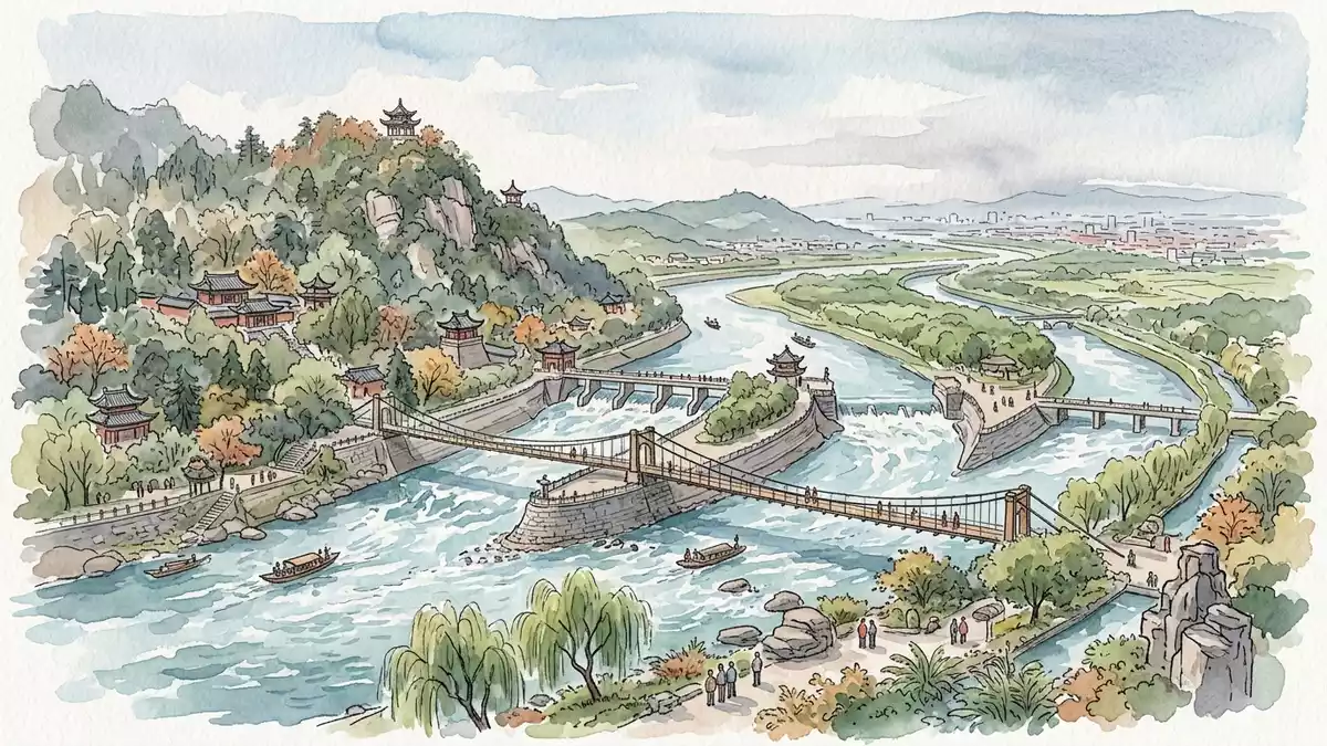
Dujiangyan is an ancient water-management system on the Minjiang River, west of the Chengdu Plain in Sichuan, China. Its visible centre is a sequence of channels, embankments and stone-cut passages, connected by water rather than enclosed behind a large dam.
Li Bing, a magistrate of the Qin Dynasty’s Shu Kingdom, initiated the system in 256 BC. The river works remain linked with the farmland of the Chengdu plains, while Mount Qingcheng and its Taoist temples form the second cultural landscape within the World Heritage property.
Dujiangyan begins with a river divided in two
The system occupies the western edge of the Chengdu flatlands, where the Sichuan Basin meets the Qinghai–Tibet plateau. The Minjiang descends from the upper valley towards the plain, and the waterworks stand at the point where the river is divided into inner and outer channels.
The central works include the Yuzui Bypass Dike, the Feishayan Floodgate and the Baopingkou Diversion Passage. This three-part water system directs water towards the Chengdu plains, while channels carry away surplus flow and sediment.
Yuzui occupies the river and separates the current into two courses. The outer course follows the Minjiang, while the inner course reaches the plain through Baopingkou. Feishayan connects the inner and outer waterways, and Baopingkou forms the controlled passage through the rock beside Lidui.
Li Bing and a Qin-era engineering landscape
Dujiangyan began during the Warring States period, when the Qin Dynasty controlled the Shu region. Li Bing is named as the official responsible for the project, and Wen Weng extended the works in 141 BC.
The early system included the cutting of the Lidui platform, the excavation of canals and the opening of a navigation route. Its later history includes additions during the Tang, Song, Yuan and Ming dynasties, when embankments, canals and maintenance practices developed around the original works.
The name Baopingkou means “Treasure Bottle Neck”. The passage cuts through the rock between Lidui and the opposite cliff, and its confined entrance is one of the clearest physical features of the site. The Qin-era foundation of Dujiangyan remains part of the landscape seen beside the river.
Water is the organising material of Dujiangyan. Visitors encounter moving channels, sloping banks, weirs and cut rock, while the surrounding plain extends beyond the headworks. The site is therefore both an engineered landscape and a working part of regional water management.
World Heritage beside Mount Qingcheng
Mount Qingcheng lies south of the irrigation system and gives the wider heritage property its religious dimension. Zhang Ling founded the doctrine of Chinese Taoism on the mountain in 142 CE, and temples built during subsequent dynasties preserve the connection between the landscape and Taoist history.
Erwang Temple stands beside the river works, while Fulong Temple occupies the Lidui platform. Changdao Temple is associated with the place where Zhang Ling preached, and Jianfu Palace belongs to the mountain’s Taoist architectural tradition.
Mount Qingcheng and the Dujiangyan Irrigation System entered the World Heritage List in 2000. The designation joins hydraulic engineering, agricultural water management and Taoist culture within one property. UNESCO describes Dujiangyan as an ecological engineering feat begun around 256 BC, with the system’s works and irrigated area forming its principal parts.
The relationship between the river and the mountain gives the visit its particular character. At the waterworks, the focus is on channels and flow. At Qingcheng, the setting shifts towards wooded slopes, temples and religious history, while both belong to the same Chengdu-region heritage landscape.
Visiting Dujiangyan: what travellers from Western Europe should know
- Dujiangyan lies north-west of Chengdu on the Minjiang River, at the western edge of the Chengdu Plain. The Chengdu–Dujiangyan intercity railway connects Chengdu with stations serving Dujiangyan.
- The main waterworks occupy riverbanks, embankments and cut-rock passages. A visit involves uneven ground, bridges, steps and changing levels around the channels.
- Lidui Park and Erwang Temple are near the central irrigation works. Mount Qingcheng lies south of the water system and forms a separate mountain setting within the heritage property.
- The official language is Chinese and the currency is the renminbi.
- Entry requirements depend on your nationality; UK travellers can check the FCDO travel advice at gov.uk/foreign-travel-advice, Irish travellers the Department of Foreign Affairs at ireland.ie.
Searching for Dujiangyan on social platforms
These links open searches for Dujiangyan on each platform.Frequently asked questions about Dujiangyan
Where is Dujiangyan?
Dujiangyan is in Sichuan, west of Chengdu, on the Minjiang River at the western edge of the Chengdu Plain. The waterworks lie near Dujiangyan City, with Mount Qingcheng south of the irrigation system.
What can visitors expect at the site?
The visit centres on river channels, embankments, bridges, cut rock and historic temples. The surrounding heritage property also includes Mount Qingcheng and its Taoist buildings.
What makes Dujiangyan distinctive?
Its three principal works are Yuzui, Feishayan and Baopingkou. Together they form a large irrigation system begun in 256 BC and associated with Li Bing, without a large dam across the Minjiang.


