
Farangi Samarias and the limestone cut through Kreta
Published on 09/18/2026 at 11:45 | Editorial responsibility: Rafael Müller, Editor-in-Chief AD HOC NEWS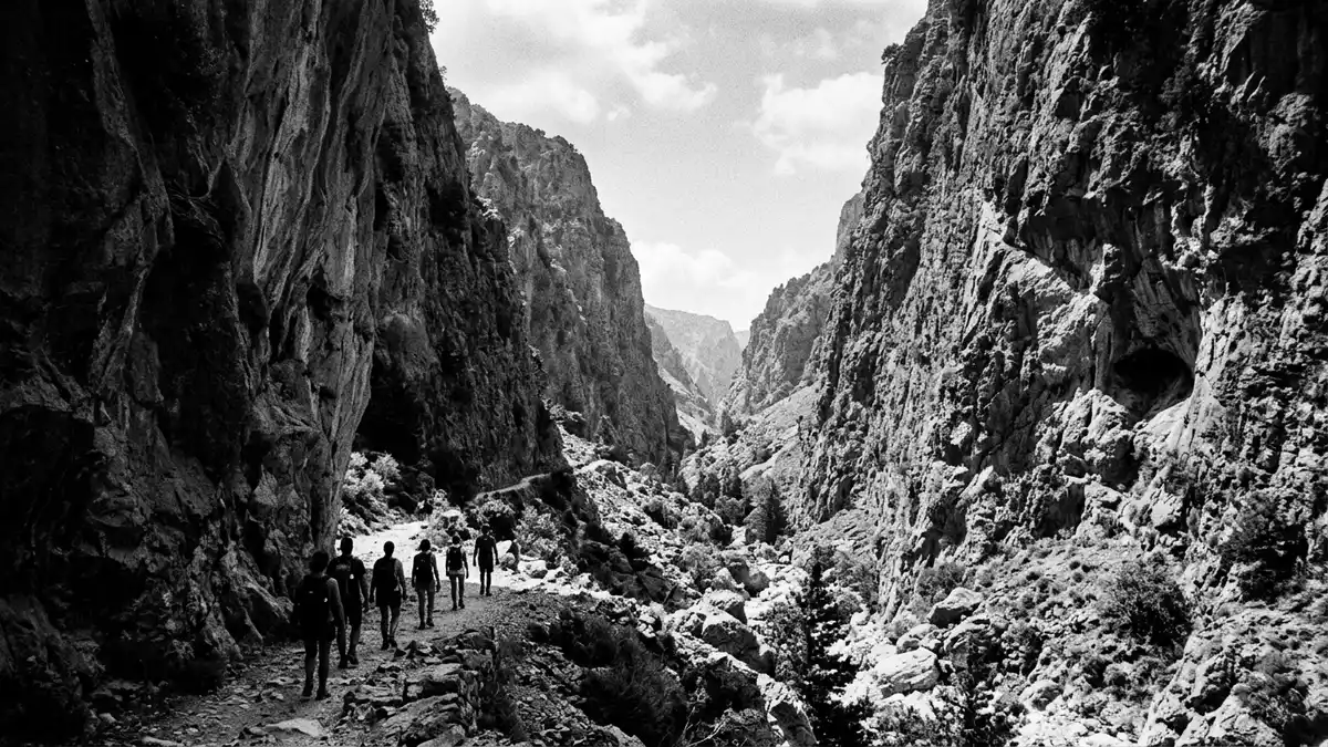
Farangi Samarias, known in English as the Samaria Gorge, is a limestone cut through the White Mountains of Kreta in Greece. It runs from the Omalos plateau down to Agia Roumeli and the Libyan Sea, with the Samaria National Park designated in 1962.
Farangi Samarias between Omalos and Agia Roumeli
The gorge lies in south-west Kreta, within the regional unit of Chania, and belongs to the Lefka Ori, or White Mountains. The route links an upland plateau with a coastal settlement, so its shape is read in one long descent rather than in separate sections.
The most recognisable section is the limestone corridor itself, with steep rock walls on both sides and a narrow floor that follows the line of the gorge. One source of context places it within a wider protected mountain landscape recognised as a UNESCO biosphere reserve, alongside the National Park of the White Mountains.
Farangi Samarias as a protected mountain landscape
The national park status dates from 1962, and that date belongs to the formal identity of the place. The landscape is not just a gorge but part of a larger mountain system shaped by limestone, ridges and the descent towards the south coast.
Farangi Samarias is also associated with the long walking route that follows the gorge from Xyloskalo above Omalos to Agia Roumeli. The route measures about 16 km (10 mi) in its commonly described form, making distance part of the place’s character as much as the rock itself.
Farangi Samarias in the White Mountains
The White Mountains provide the wider frame for the gorge, and their name is part of the place’s identity. The landscape combines high interior ground, deep limestone walls and the open edge of the Libyan Sea.
The route’s first section begins at high altitude near Omalos, and the terrain then drops steadily towards the coast. That contrast between upland plateau and sea-facing exit is the most immediate way to read Farangi Samarias on a map or on foot.
Visiting Farangi Samarias: what travellers from Western Europe should know
- The gorge lies in south-west Kreta, in the regional unit of Chania. It is reached from the Omalos side by road, with Agia Roumeli at the southern end.
- The terrain is a limestone gorge with a long descent and steep rock walls. The route covers about 16 km (10 mi) in its familiar through-walk form.
- The official language is Greek and the currency is the euro.
- Entry requirements depend on your nationality; UK travellers can check the FCDO travel advice at gov.uk/foreign-travel-advice, Irish travellers the Department of Foreign Affairs at ireland.ie.
Searching for Farangi Samarias on social platforms
These links open searches for Farangi Samarias on each platform.
Frequently asked questions about Farangi Samarias
Where is Farangi Samarias?
Farangi Samarias lies in south-west Kreta, in the regional unit of Chania. It runs through the White Mountains from the Omalos plateau to Agia Roumeli on the Libyan Sea.
What should a visitor expect?
The place is a limestone gorge with steep walls, a long descending route and a strong sense of scale. The through-walk is about 16 km (10 mi) in its familiar form.
What makes it distinctive?
Its identity combines a deep mountain cut, a protected national park and a direct line from plateau to coast. The 1962 national park designation anchors that landscape in a formal conservation setting.


