
Farangi Samarias from plateau to the Libyan Sea
Published on 09/24/2026 at 03:20 | Editorial responsibility: Rafael Müller, Editor-in-Chief AD HOC NEWS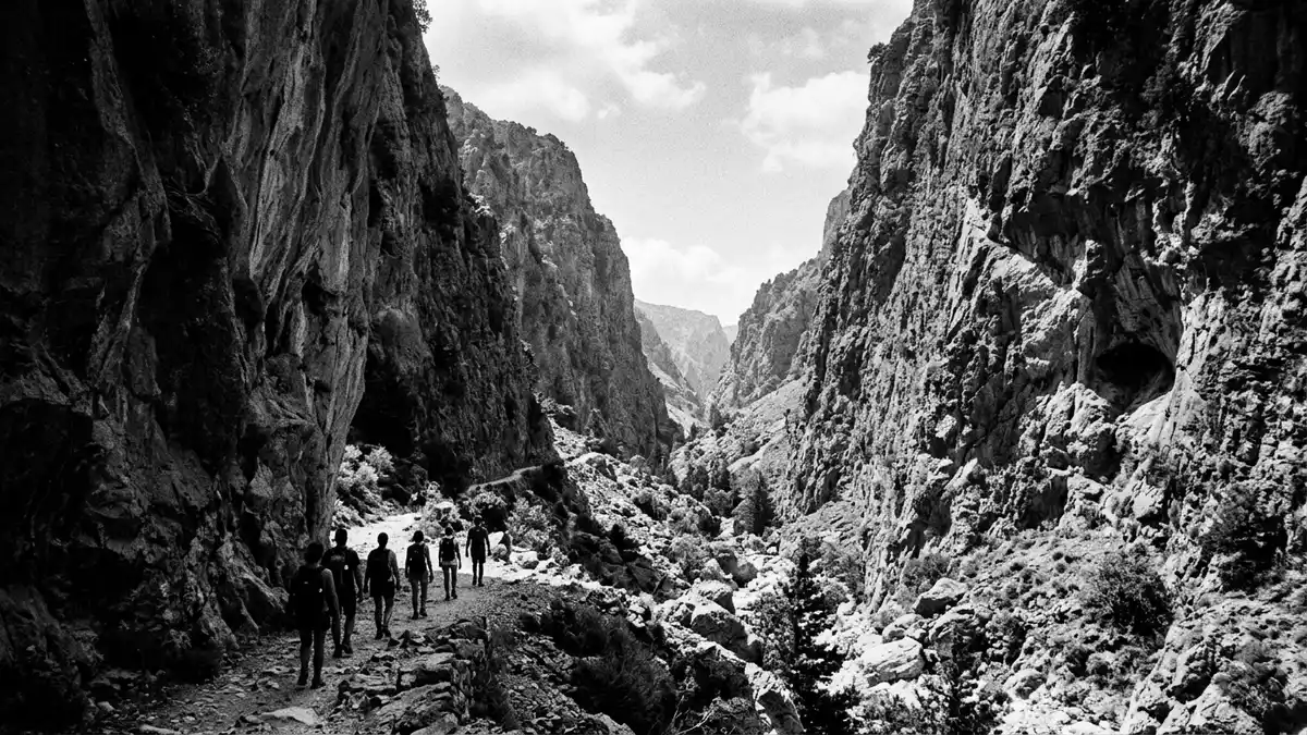
Farangi Samarias is a limestone gorge crossing the White Mountains of western Kreta from the Omalos plateau towards the Libyan Sea. Its changing scale is visible along the route, from upland terrain to the narrow passage known as the Gates.
Farangi Samarias begins among the White Mountains
The gorge lies in the regional unit of Chania, within the Lefka Ori, the largest and westernmost mountain range on Kreta. The northern entrance is at Xyloskalo, on the edge of the Omalos plateau, at an altitude of about 1,200 metres.
The route descends through limestone and marble terrain shaped by water and tectonic movement. The rock belongs to the Mesozoic geological era, whose limestone and dolomite formations date from roughly 225 to 140 million years ago. the Mesozoic rock formations form part of the wider geology of the Lefka Ori.
The gorge narrows at the Gates
Farangi Samarias extends for about 16 kilometres between the highlands and the coast, although descriptions distinguish the main gorge from the complete route to Agia Roumeli. The passage includes ravines, streams, boulder fields, ledges and sections beneath steep limestone walls.
At the Gates, the walls close to a gap of roughly four metres, while the rock rises to almost 300 metres. This narrow section gives the route its strongest change of scale, placing a small passage between towering surfaces of pale rock. the route to Agia Roumeli continues southwards from the gorge towards the Libyan Sea.
National park, wildlife and Cretan history
Farangi Samarias became a national park in 1962. The protected area preserves mountain habitats, endemic plants and animals associated with Kreta, including the Cretan agrimi, also called the kri-kri, whose scientific name is Capra aegagrus cretica.
The Lefka Ori contain limestone landscapes, caves, sinkholes, plateaux and several gorges. Birds of prey include the bearded vulture and golden eagle, while the vegetation includes endemic species such as Zelkova abelicea and Bupleurum kakiskalae. The gorge and its surrounding mountain area form a UNESCO Biosphere Reserve, a designation held since 1981.
Human history is also present within the landscape. The ancient settlement of Tarra stood near the southern exit, and the gorge contains the remains of Samaria, the settlement that gave the place its name. Ancient Kaino is associated with the Cretan goddess Britomartis, identified with an earlier form of Artemis. The gorge served as a refuge during periods of conflict in Cretan history.
Visiting Farangi Samarias: what travellers from Western Europe should know
- Farangi Samarias lies in western Kreta, south of Chania. Access to Xyloskalo is by road through the Omalos plateau, while Agia Roumeli is reached from the coastal side.
- The route descends from about 1,200 metres at Xyloskalo towards the Libyan Sea. Its surface includes stone, uneven ground, streams and steep sections near the northern entrance.
- The complete route to Agia Roumeli is about 16 kilometres, with the main gorge described separately as roughly 12.5 to 13 kilometres.
- The southern end is at Agia Roumeli, a coastal settlement on the Libyan Sea. Boat connections from the village link the coast with places including Chora Sfakion, Loutro and Paleochora.
- The official language is Greek and the currency is the euro.
Searching for Farangi Samarias on social platforms
These links open searches for Farangi Samarias on each platform.
Frequently asked questions about Farangi Samarias
Where is Farangi Samarias?
Farangi Samarias is in western Kreta, within the Lefka Ori and the regional unit of Chania. The route runs from Xyloskalo on the Omalos plateau to Agia Roumeli on the Libyan Sea.
What does the route contain?
The route includes a highland entrance, a long limestone gorge, streams, uneven ground and the narrow Gates. The complete route to Agia Roumeli is about 16 kilometres.
What makes Farangi Samarias distinctive?
Its defining contrast is the change from an elevated plateau to a coastal outlet, with the passage narrowing to about four metres between walls approaching 300 metres high. Its national park status and 1981 Biosphere Reserve designation also reflect its geological and biological importance.


