
Franz Josef Glacier where rainforest meets moving ice
Published on 09/23/2026 at 11:57 | Editorial responsibility: Rafael Müller, Editor-in-Chief AD HOC NEWS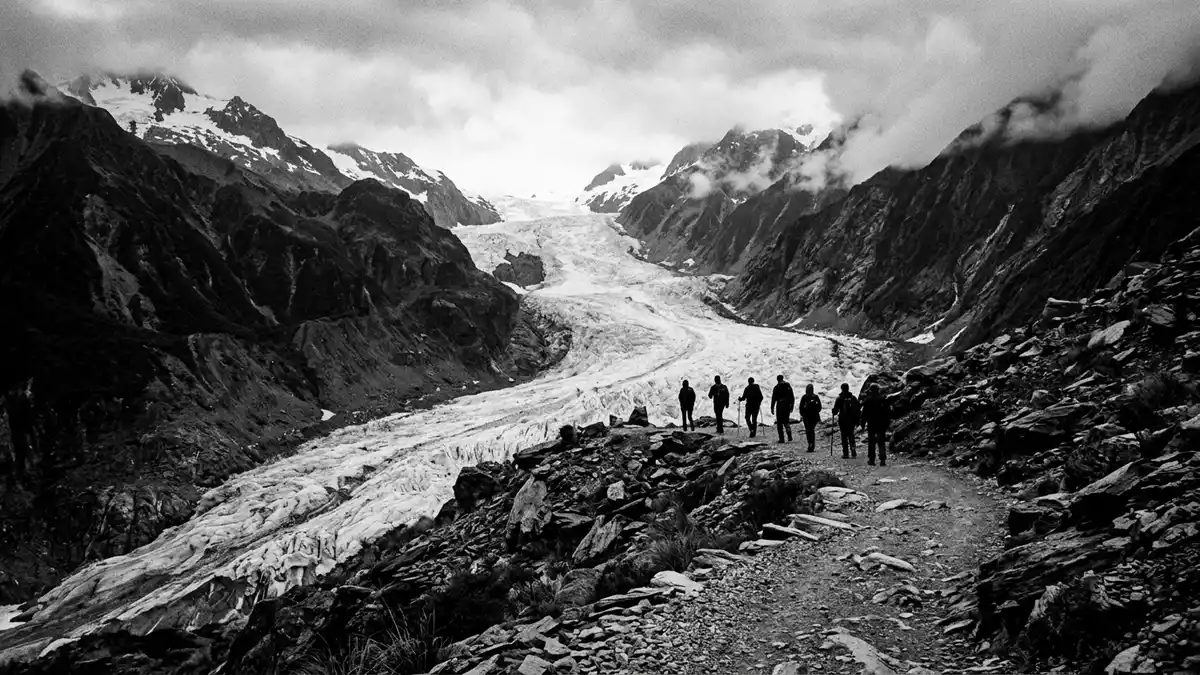
Franz Josef Glacier descends from the Southern Alps into temperate rainforest on New Zealand’s South Island. Its M?ori name, K? Roimata o Hine Hukatere, connects the ice to a local cultural tradition, while the European name dates from 1865.
Ice descending into Westland rainforest
Franz Josef Glacier lies in Westland Tai Poutini National Park, within the Te W?hipounamu South West New Zealand World Heritage Area. The glacier is a temperate maritime glacier, shaped by snowfields high in the Southern Alps and by ice flowing down the Waiho Valley.
The terminal face lies less than 300 metres above sea level. This lowland position places glacial ice, schist outcrops, river channels and native rainforest within the same landscape. the low terminal face is a defining physical feature of the valley.
K? Roimata o Hine Hukatere and the 1865 name
The glacier’s M?ori name is K? Roimata o Hine Hukatere, translated as “the tears of Hine Hukatere”. The name preserves a cultural association that predates European mapping and naming in the area.
Geologist Julius von Haast reached the glacier in 1865 and named it after Franz Joseph I, the Austrian emperor. The same year also appears in the history of Sentinel Rock, which emerged from beneath retreating ice during Haast’s visit. Julius von Haast’s exploration forms the European historical anchor of Franz Josef Glacier.
Schist, river channels and a changing glacier
Ice has shaped the valley floor and exposed hard schist bedrock. Sentinel Rock and nearby outcrops carry rounded forms produced by glacial abrasion, while rubble-covered ground supports plant succession from low shrubs towards native forest.
The glacier has advanced and retreated through the landscape during different climatic periods. During the last ice age, an extensive ice sheet reached beyond the present coastline. The surviving valley records that larger frozen landscape through its rocks, deposits and vegetation.
Franz Josef Glacier is also a moving body of ice. Its surface changes as snow accumulates high in the Southern Alps, compresses into ice and flows towards the Waiho River. the glacier’s physical dimensions place movement at the centre of its character.
Visiting Franz Josef Glacier: what travellers from Western Europe should know
- Franz Josef Glacier lies south of Franz Josef township in Westland Tai Poutini National Park. The approach follows the Waiho River bridge and Franz Josef Glacier Access Road.
- The valley contains river channels, schist outcrops and uneven glacial terrain. Walking tracks begin near the access-road car park and lead towards viewpoints of the terminal area.
- The terminal face is an active glacial environment. Ice collapse, rock fall and rapidly changing river channels are permanent features of the setting.
- The official language is English and the currency is the New Zealand dollar.
- Entry requirements depend on your nationality; UK travellers can check the FCDO travel advice at gov.uk/foreign-travel-advice, Irish travellers the Department of Foreign Affairs at ireland.ie.
Searching for Franz Josef Glacier on social platforms
These links open searches for Franz Josef Glacier on each platform.
Frequently asked questions about Franz Josef Glacier
Where is Franz Josef Glacier?
Franz Josef Glacier lies on the West Coast of New Zealand’s South Island, south of Franz Josef township. It occupies the Waiho Valley within Westland Tai Poutini National Park.
What can visitors expect at the glacier?
Visitors encounter rainforest, river channels, schist outcrops and viewpoints towards the terminal area. The glacier itself is an active environment with changing ice, rock and water.
What makes Franz Josef Glacier distinctive?
Its ice descends from the Southern Alps towards temperate rainforest, with the terminal face less than 300 metres above sea level. Its M?ori name is K? Roimata o Hine Hukatere.


