
Kinderdijk’s windmills in a landscape of water
Published on 09/10/2026 at 07:25 | Editorial responsibility: Rafael Müller, Editor-in-Chief AD HOC NEWS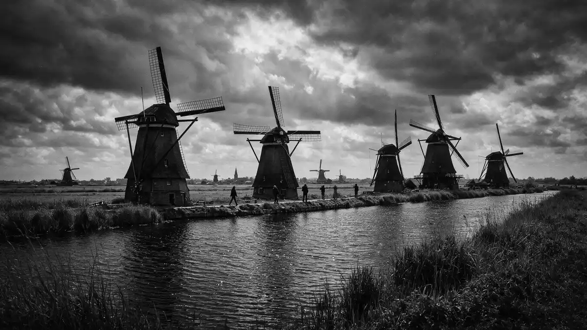
Kinderdijk is a Dutch landscape of canals, dikes and windmills in South Holland. Its 18th-century mill network and UNESCO World Heritage status give it a clear historic shape.
Kinderdijk’s mill network and water landscape
The Mill Network at Kinderdijk-Elshout brings together windmills, pumping stations, reservoirs and administrative buildings in one engineered landscape. The UNESCO listing identifies it as a group of buildings within a human-made setting that reflects Dutch water management.
Several parts of the system date from the eighteenth century, including the windmills built in 1738 and 1740. The site’s official name, Mill Network at Kinderdijk-Elshout, appears in the World Heritage register.
Windmills, polders and a working water system
Kinderdijk sits in the Alblasserwaard area of South Holland, where peat land and low-lying polders shaped the historic water network. The landscape includes ditches, embankments, drainage channels and a series of preserved mills.
Kinderdijk’s heritage is linked to the long Dutch practice of managing water through drainage works and wind-driven mills. The site’s history page traces that system through the Middle Ages and into the first half of the eighteenth century, when the present mill network took shape. History of Kinderdijk sets out that development in sequence.
Why the landscape reads so clearly
What gives Kinderdijk its force is the visible contrast between horizontal water lines and the upright mills. The UNESCO description notes dykes, reservoirs, pumping stations and windmills as the main elements of the site.
The mills remain the most recognisable part of the ensemble, but they sit within a broader system rather than standing alone. The heritage listing also records that the group contains nineteen drainage mills and three pumping stations. the windmills line the canals is how the setting is often introduced, and the phrase fits the view on site.
Visiting Kinderdijk: what travellers from Western Europe should know
- Kinderdijk lies in South Holland, within the Alblasserwaard landscape. It is reached through the road and waterway network of the Rotterdam area, and the village of Kinderdijk gives the place its name.
- The ground is flat, with canals, dikes and narrow paths between the water features. The landscape is open and exposed, with long lines of sight across the polder.
- The UNESCO World Heritage designation covers the Mill Network at Kinderdijk-Elshout. The formal title is part of the site’s identity and helps distinguish it from a simple village landscape.
- The windmills are the best-known structures in the ensemble, but the site also includes pumping stations and reservoir works. Those elements make the place read as a managed water landscape rather than a row of isolated monuments.
- The official language is Dutch and the currency is the euro.
Searching for Kinderdijk on social platforms
These links open searches for Kinderdijk on each platform.
Frequently asked questions about Kinderdijk
Where is Kinderdijk?
Kinderdijk is in South Holland in the Netherlands, in the Alblasserwaard polder landscape. It is associated with the village of Kinderdijk and the Mill Network at Kinderdijk-Elshout.
What does a visit involve?
The place is an open landscape of canals, dikes, mills and pumping works. The main experience is seeing how the elements fit together as a single water-management setting.
What makes Kinderdijk distinctive?
The combination of nineteenth-century-scale drainage works is not the point here; the distinction lies in the preserved eighteenth-century mill network and its UNESCO World Heritage title. The site keeps its water landscape legible in a way that is easy to read from the paths and canals.


