
Mount Kenya National Park’s high-altitude world above Nanyuki
Published on 09/21/2026 at 06:08 | Editorial responsibility: Rafael Müller, Editor-in-Chief AD HOC NEWS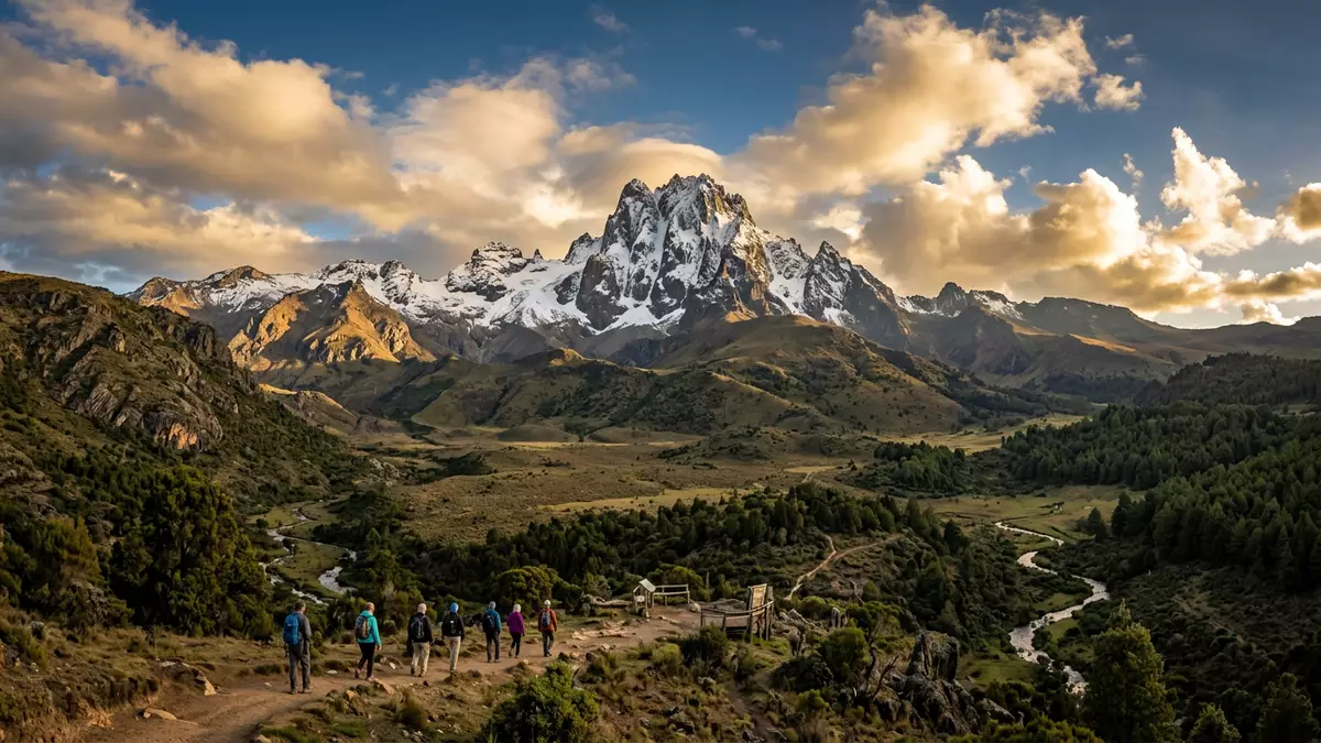
Mount Kenya National Park wraps around Mount Kenya’s upper slopes, enclosing a high-altitude world of forests, moorland and glaciated summits above the Kenyan town of Nanyuki. Established as a national park in 1949, it later formed the core of a larger protected area recognised on the UNESCO World Heritage List for its striking mountain scenery and ecological processes in the late twentieth century.recognised on the UNESCO World Heritage List
Mount Kenya’s massif and peaks inside the park
The centre of Mount Kenya National Park is Mount Kenya itself, an extinct stratovolcano rising to a highest summit of about 5,199 m (17,060 ft) above sea level, making it the second-highest mountain in Africa after Kilimanjaro.an extinct stratovolcano rising to a highest summit The upper part of the massif is carved into ridges, rock towers and cirques shaped by past glaciation, with the main peaks Batian and Nelion forming steep rock pinnacles above surrounding cliffs and scree slopes.the main peaks Batian and Nelion
Around this rocky core, Mount Kenya National Park protects a band of Afro-alpine and montane habitats that feed major rivers flowing across central Kenya. The protected area recognised by UNESCO as Mount Kenya National Park/Natural Forest combines the national park with surrounding forest reserves, forming a serial property whose extent reaches hundreds of thousands of hectares.Mount Kenya National Park/Natural Forest Within this wider landscape, the park area itself covers several hundred square kilometres, encircled by forest that links high slopes with lower foothills.the park covers 715 square kilometres
UNESCO status and protected forest around Nanyuki
Mount Kenya National Park was created in 1949 to protect the mountain’s higher slopes, and in 1978 the wider area gained recognition as a biosphere reserve under UNESCO’s Man and the Biosphere Programme.biosphere reserve under UNESCO’s Man and the Biosphere Programme In 1997, the national park and adjacent forest reserves were inscribed together on the UNESCO World Heritage List under natural criteria (vii) and (ix), reflecting the mountain’s outstanding natural beauty and the ecological processes visible across its altitudinal range.inscribed on the UNESCO World Heritage List
The World Heritage property later expanded to include the Lewa Wildlife Conservancy and Ngare Ndare Forest Reserve to the north, extending protection from the alpine zone down into wildlife-rich foothills and forests.include the Lewa Wildlife Conservancy and Ngare Ndare Forest Reserve Across this combined area, forest and moorland around Mount Kenya act as an important “water tower” for Kenya, collecting moisture and feeding river systems that run away from the massif towards lower country.forest and moorland around Mount Kenya act as an important water tower
Approach routes and high-altitude terrain above Nanyuki
Mount Kenya straddles the equator in central Kenya, with Nanyuki lying to the north-west as one of the principal gateway towns on its lower slopes.principal gateway towns on its lower slopes Road approaches from Nanyuki reach park entrances such as the Sirimon Gate, which stands at an elevation where montane forest begins to thin towards glades and tracks leading higher into the moorland.Sirimon Gate is 200 km from Nairobi Other approach routes, including Naro Moru and Chogoria, climb different flanks of the massif and give access to contrasting terrain on the way towards the main peaks.Naro Moru and Chogoria
Inside the park, altitude rises from dense forest through a zone of bamboo and open moorland into rocky ground, where tarns and remnant glaciers sit below jagged summits such as Batian. Elevation differences are marked, with park areas reaching well above 4,000 m (13,123 ft) and Mount Kenya’s highest point standing higher still.park in Meru County at 4,828 m elevation Trails and climbing routes cross this varied terrain, passing lakes, ridges and glaciers that show the mountain’s volcanic origin and glacial history.volcanic origin and glacial history
Visiting Mount Kenya National Park: what travellers from Western Europe should know
- Mount Kenya National Park lies in central Kenya north of Nairobi, with Nanyuki on the north-western side acting as a common base town for road access towards park gates.
- The terrain inside the park ranges from forested lower slopes to steep high-altitude moorland and rocky ridges, and approaches towards the summits involve sustained ascents on mountain paths.
- Several named routes, including Sirimon, Naro Moru and Chogoria, reach different sides of the mountain and are accessed by roads linking gateway towns with park entrances.
- The official language is English and the currency is the Kenyan shilling.
- Entry requirements depend on your nationality; UK travellers can check the FCDO travel advice at gov.uk/foreign-travel-advice, Irish travellers the Department of Foreign Affairs at ireland.ie.
Searching for Mount Kenya National Park on social platforms
These links open searches for Mount Kenya National Park on each platform.
Frequently asked questions about Mount Kenya National Park
Where is Mount Kenya National Park in relation to Nanyuki?
Mount Kenya National Park surrounds the upper slopes of Mount Kenya in central Kenya, with Nanyuki on the north-western side acting as a convenient base town for access.
What kind of landscape should visitors expect inside the park?
Visitors encounter forested lower slopes that rise into bamboo and open moorland, then into rocky ridges, tarns and glaciated summits around the main peaks.
What makes Mount Kenya National Park distinctive among African mountain parks?
Mount Kenya National Park combines the continent’s second-highest mountain, a documented volcanic and glacial landscape and recognised UNESCO World Heritage and biosphere reserve status in one protected area.


