
Serengeti National Park and the moving grasslands
Published on 09/24/2026 at 02:58 | Editorial responsibility: Rafael Müller, Editor-in-Chief AD HOC NEWS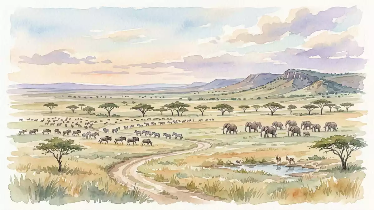
Serengeti National Park is a landscape of grass, rock and moving herds in northern Tanzania. The park’s open plains are broken by kopjes, river valleys, woodland and wetlands, while the annual movement of wildebeest, gazelles and zebras links the Serengeti with neighbouring ecosystems.
Established in 1951 and inscribed on the UNESCO World Heritage List in 1981, Serengeti National Park covers 14,763 square kilometres. Its scale is easiest to understand through the relationship between its habitats: short grass plains, acacia savannah, rivers, forests and isolated granite outcrops.
Serengeti National Park: plains marked by kopjes
The southern and central Serengeti are associated with broad grasslands. In some areas, the land is nearly treeless, with low vegetation spreading across gently rolling terrain. Rocky kopjes interrupt the grass, forming compact outcrops of exposed stone within the plain. These formations are among the park’s most recognisable landscape features.
Further west, the scenery includes woodland and riverine forest. The Grumeti and Mbalageti rivers cross the western corridor before continuing towards Lake Victoria. In the north, the Mara River links the Serengeti ecosystem with Kenya’s Maasai Mara, while wetlands and seasonal watercourses add further habitat variety.
The park lies beside the Ngorongoro Conservation Area and extends towards the Kenyan border. Together with surrounding reserves and protected areas, it forms part of a broader ecological region whose animals move across administrative boundaries.
From grassland refuge to World Heritage landscape
Serengeti National Park was established in 1951, after earlier forms of protection had been applied to parts of the Serengeti. Its boundaries changed during the twentieth century, and the Ngorongoro Conservation Area became a separate protected landscape in 1959.
The park’s formal international status followed in 1981, when it joined the UNESCO World Heritage List for its natural scenery and ecological importance. The designation covers a landscape rather than a single monument, with grasslands, woodland, rivers and wildlife forming one connected setting. UNESCO World Heritage status
Maasai communities have long been associated with the wider Serengeti and Ngorongoro region. The history of conservation in the area includes changes to land use, boundaries and access, making the park part of a larger cultural and political history as well as a protected natural site.
The park is administered within Tanzania’s national parks system. Its protected area covers about 14,763 square kilometres, while the wider Serengeti-Mara ecosystem extends beyond the park itself. Serengeti’s established area
Migration, predators and a chain of habitats
The annual migration is the park’s best-known ecological process. Large herds of wildebeest move through the Serengeti-Mara ecosystem with zebras and gazelles, following changing supplies of grass and water. The movement crosses Tanzania and Kenya, and its route changes with rainfall and pasture.
The migrating herbivores share the landscape with lions, leopards, cheetahs, spotted hyenas and African wild dogs. Elephants, giraffes, rhinoceroses, hippopotamuses and baboons also occur in the wider park environment. Crocodiles inhabit parts of the Mara River, while birds include ostriches, vultures and flamingos.
The migration is not a single procession across one uniform plain. It is a cycle through different habitats, including the short grasslands of the south, the western woodland corridor and the northern plains. Each section has its own vegetation, watercourses and rocky features.
The UNESCO description records approximately 1.5 million hectares of savannah within the listed landscape and identifies the annual movement of wildebeest, gazelles and zebras as a central natural feature. the migrating herds
Serengeti National Park therefore functions as both a destination and a geographical idea: a protected area whose character comes from motion across open land. Grassland, rock and water form the visible setting, while the animals connect one part of the ecosystem with another.
Visiting Serengeti National Park: what travellers from Western Europe should know
- Serengeti National Park lies in northern Tanzania, west of the Ngorongoro Conservation Area and near the Kenyan border. Overland routes use access points including Naabi Hill and Ndabaka, while flights use airstrips such as Seronera.
- The terrain includes open grassland, rocky kopjes, woodland, river valleys and wetlands. Travel within the park takes place across a large protected area with changing ground conditions.
- The park’s elevation ranges from about 920 m to 1,850 m (3,020 ft to 6,070 ft). The climate includes a wetter period and a drier period, with rainfall patterns shaping the movement of wildlife.
- The official language is Swahili and the currency is the Tanzanian shilling.
- Entry requirements depend on your nationality; UK travellers can check the FCDO travel advice at gov.uk/foreign-travel-advice, Irish travellers the Department of Foreign Affairs at ireland.ie.
Searching for Serengeti National Park on social platforms
These links open searches for Serengeti National Park on each platform.
Frequently asked questions about Serengeti National Park
Where is Serengeti National Park?
Serengeti National Park is in northern Tanzania, beside the Ngorongoro Conservation Area and near the border with Kenya.
What can visitors expect in the park?
The landscape includes grasslands, kopjes, rivers, woodland and wetlands, with large mammals and many bird species distributed across these habitats.
What makes Serengeti National Park distinctive?
Its defining feature is the annual movement of wildebeest, zebras and gazelles through the connected Serengeti-Mara ecosystem.


