
Setenil de las Bodegas and its streets carved into rock
Published on 09/15/2026 at 06:47 | Editorial responsibility: Rafael Müller, Editor-in-Chief AD HOC NEWS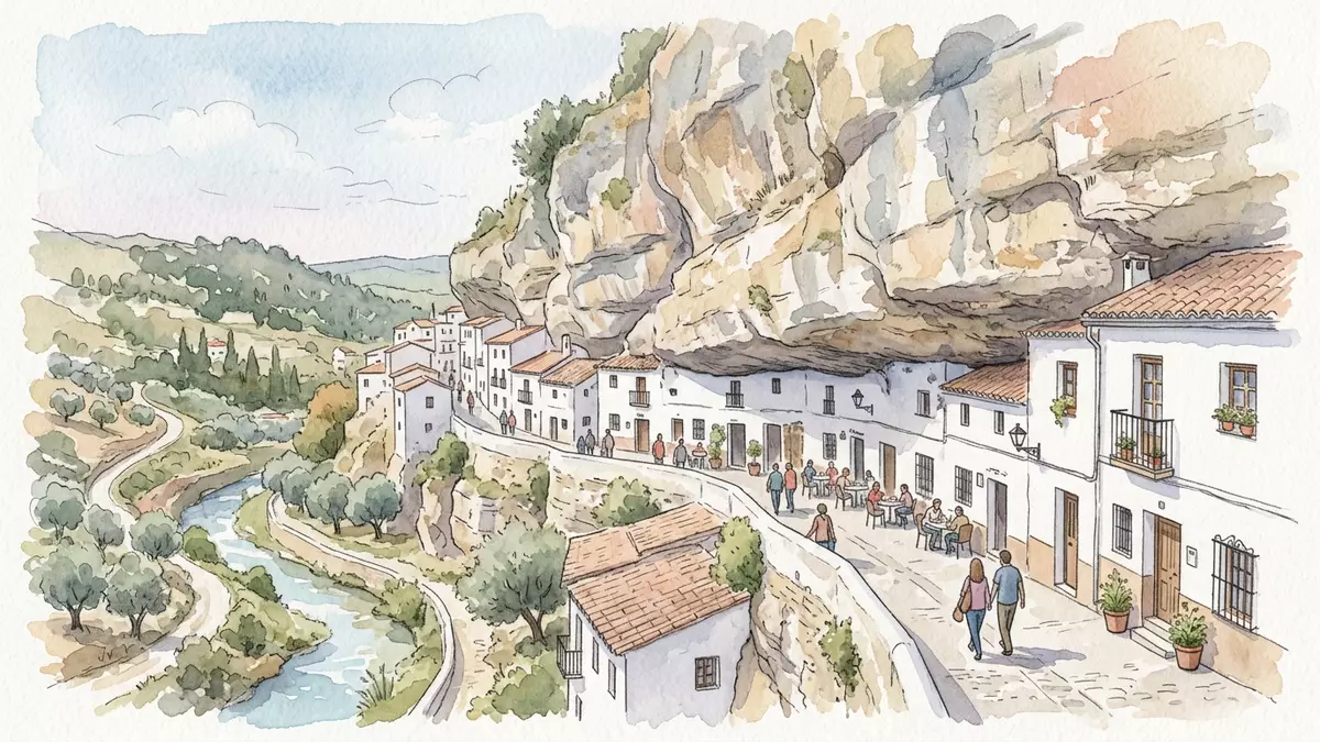
Setenil de las Bodegas in Setenil, Spain takes the idea of a white village and pushes it into the rock itself, with streets and houses pressed against a steep river gorge. Its urban centre follows the line of the canyon cut by the Rio Trejo, where whitewashed façades share space with broad overhanging rock that forms natural shelter above everyday life.
Streets beneath overhanging rock
The most striking aspect of Setenil de las Bodegas is the way ordinary streets run directly beneath the cliff, so that rock and architecture read almost as one continuous wall. In several parts of the town, long sections of overhanging sandstone project above pavements and ground floors, creating corridors where ceilings are formed not by concrete slabs but by the natural strata of the gorge. This relationship between geology and urban fabric is clearest along the streets that follow the bend of the river, where the canyon narrows and the rock sits very close behind the houses.cave houses built underneath boulders
Buildings in these sections often have one elevation facing the street and another pressed directly against the rock face, with upper storeys stepping back where the cliff retreats. Many façades are finished in the familiar white of the pueblos blancos, and this strong colour contrast makes the line of the rock more pronounced as it curves above the town. The canyon itself is the work of the Rio Trejo, whose course has carved a deep channel into the plateau of the Sierra de Cádiz over thousands of years, leaving vertical faces on which the settlement now hangs.massive overhanging rocks carved out by the Rio Trejo
A medieval hilltop and a rock-clinging town
Above the gorge, Setenil de las Bodegas keeps the outline of a medieval hilltop stronghold, with the remains of an Almohad castle occupying a high promontory that overlooks the winding streets below. The castle’s keep, known as the Torre del Homenaje, and its surviving cistern are part of a fourteenth-century defensive complex that once controlled access through this part of the mountains of Cádiz.an Arab fortress of the fourteenth century Around this high point, the oldest neighbourhood, La Villa, occupies a plateau where lanes are tighter and houses cluster around the church of Nuestra Señora de la Encarnación.
Setenil’s position on the northern edge of the province of Cádiz placed it on the front line during the Reconquista, when the Crown of Castile advanced towards Granada. Chroniclers describe how forces under John II of Castile and, later, the Catholic Monarchs attacked the fortified town repeatedly; the decisive siege ended on 21 September 1484, when Setenil passed into Castilian control and was declared a royal township. In 1501 it received a charter of privileges comparable to those granted to Seville, highlighting its strategic value in the network of settlements along this mountain corridor.a charter of privileges in 1501 In 1630, after disputes with the nearby city of Ronda, Setenil gained independence by royal decree.
White village, historic ensemble and agricultural landscape
Setenil de las Bodegas forms part of the Ruta de los Pueblos Blancos, the famous route of white villages that threads through the Sierras of Cádiz and Málaga. Like its neighbours, it presents terraces of whitewashed houses, narrow lanes and small squares, but the way its urban plan follows the canyon gives it a markedly vertical profile. The municipality stands at an elevation of over 600 m (about 2,000 ft) above sea level on a plateau cut by the Rio Trejo, and its area extends across more than 80 km² of fields and hills planted with olives and cereals.altitude and municipal area
The town has been recognised for the singular way its historic centre integrates built forms and rock. In 1985 its core was declared a “Conjunto histórico-artístico”, a protected historic-artistic ensemble under Spanish heritage law, acknowledging both the medieval remains and the distinctive later streets that use the canyon walls as structural backing.historic-artistic ensemble in 1985 Religious buildings such as the parish church of Nuestra Señora de la Encarnación and hermitages dedicated to Nuestra Señora del Carmen, San Benito and San Sebastián form further focal points, rising above the lower layers of houses that cling more closely to the river course.
Visiting Setenil de las Bodegas: what travellers from Western Europe should know
- Setenil de las Bodegas lies in the north-eastern part of the province of Cádiz in Andalusia, with road links from towns such as Ronda and other white villages on the Ruta de los Pueblos Blancos.
- The historic centre climbs around a steep river gorge, with streets that slope sharply and several sections running beneath overhanging rock, so walking involves gradients, steps and uneven surfaces.
- The municipality extends over hilly agricultural land, with approaches by road that wind through olive groves and cereal fields rather than broad plains.
- The official language is Spanish and the currency is the euro.
Searching for Setenil de las Bodegas on social platforms
These links open searches for Setenil de las Bodegas on each platform.
Frequently asked questions about Setenil de las Bodegas
Where is Setenil de las Bodegas?
Setenil de las Bodegas is a municipality in the province of Cádiz in Andalusia, Spain, on the northern edge of the Sierra de Cádiz and within the Ruta de los Pueblos Blancos.
What can visitors expect on a visit to Setenil de las Bodegas?
Visitors encounter streets and houses built alongside and beneath overhanging canyon rock, a steep historic centre climbing around the gorge, and viewpoints towards a medieval hilltop quarter and surrounding agricultural hills.
What makes Setenil de las Bodegas distinctive among Andalusian white villages?
Setenil is distinctive because large parts of its urban centre are integrated directly with the gorge carved by the Rio Trejo, creating streets sheltered by rock, combined with a recognised historic ensemble that includes a fourteenth-century fortress and churches.


