
Zion National Park’s sandstone canyon world in Springdale
Published on 09/16/2026 at 16:41 | Editorial responsibility: Rafael Müller, Editor-in-Chief AD HOC NEWS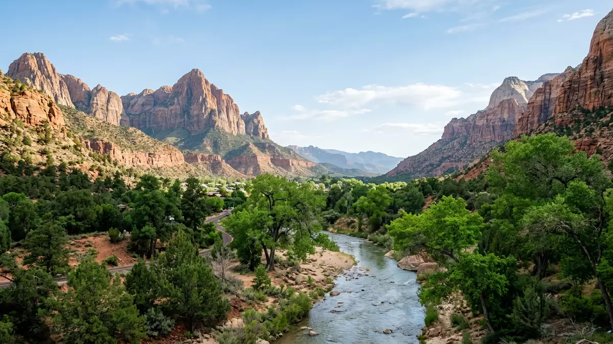
Zion National Park in southern Utah frames Springdale beneath towering Navajo Sandstone cliffs, with the North Fork of the Virgin River cutting a deep, narrow canyon through the plateau. The park lies on the western edge of the Colorado Plateau, where uplifted sedimentary layers form a sequence of colourful cliffs and benches that visitors see stacked above the valley.the Colorado Plateau Zion became a national park in 1919, when the former Mukuntuweap National Monument was redesignated under an Act signed by President Woodrow Wilson.national park in 1919
Sandstone cliffs, slot canyon and the river at the park’s core
The central feature of Zion National Park is Zion Canyon, cut by the North Fork of the Virgin River through thick beds of Navajo Sandstone that give the walls their reddish and tan colour.Navajo Sandstone At the narrowest section, known simply as the Narrows, the river fills much of the canyon floor, and high vertical cliffs rise on both sides, creating one of the park’s most distinctive walks in water between close rock faces. Elsewhere along the canyon, side gullies and alcoves open out into hanging gardens where seepage from the sandstone feeds patches of vegetation on otherwise bare rock.
The canyon walls are part of a stack of formations that record environments ranging from shallow seas to river floodplains and desert dunes, all preserved within the park’s rock sequence.rock layers from sea to desert Above the canyon floor, the cliffs break into named features such as Angels Landing, the Court of the Patriarchs and the Great White Throne, each a separate sandstone mass rising from the valley and showing cross-bedded layers that formed as ancient sand dunes migrated across a desert landscape.Angels Landing and Court of the Patriarchs
From Mukuntuweap monument to Zion National Park
Zion’s protected status dates back to an early twentieth-century move to safeguard its canyon scenery under the name Mukuntuweap National Monument, established in 1909 under President William Howard Taft.Mukuntuweap National Monument in 1909 The area was renamed Zion National Monument in 1918 and then became Zion National Park when Congress passed legislation in November 1919, with Wilson’s signature giving the park its modern designation and expanding its boundaries to include more of the surrounding canyon country.Act to establish Zion National Park
The park occupies a position along the Grand Staircase, a geological term for the series of stepped cliffs linking Bryce Canyon and the Grand Canyon, and Zion’s cliffs show several of those steps in cross-section.Grand Staircase Within its boundaries, formations such as the Moenkopi, Chinle, Moenave, Kayenta and Navajo record Triassic and Jurassic ages, giving geologists a compact view of roughly 150 million years of sedimentation within the canyon system.Triassic and Jurassic formations For visitors, this long history appears as colour changes and different cliff profiles as they move from lower canyon sections towards the higher plateaus.
Trails, viewpoints and Springdale at the south entrance
Several named trails and viewpoints bring the park’s sandstone architecture into close view. The route towards Angels Landing climbs from the canyon floor up a series of steep turns to a high ridge, where the final approach follows a narrow crest with dramatic exposure on both sides.Angels Landing route Shorter paths lead to the Emerald Pools, a set of spring-fed basins and waterfall-fed ledges above the main canyon, and to Weeping Rock, where water percolating through the sandstone emerges along a rock face, sustaining hanging plants.
Other viewpoints such as the Court of the Patriarchs and the Canyon Overlook frame groupings of cliffs and pinnacles, giving a sense of the canyon’s scale relative to the river corridor and the valley floor below.Canyon Overlook and Court of the Patriarchs At the south entrance, the town of Springdale stands immediately outside the park boundary, with roads, accommodation and services lining the valley floor beneath the cliffs.Springdale at the park entrance The juxtaposition of a small town and high canyon walls makes Zion one of the national park landscapes where the transition from everyday streets to protected terrain is experienced within a short physical step.
Visiting Zion National Park: what travellers from Western Europe should know
- Zion National Park lies in south-western Utah, with Springdale directly outside the south entrance and regional access by road from larger hubs such as Las Vegas and Salt Lake City.
- The main canyon floor sits at a moderate elevation, but trails such as Angels Landing and other rim routes involve significant height gain on constructed paths and stair-like sections.
- Many of the park’s best-known walks follow the Virgin River corridor or climb exposed slopes, so sturdy footwear and a readiness for uneven, rocky ground are important.
- The official language is English and the currency is the US dollar.
- Entry requirements depend on your nationality; UK travellers can check the FCDO travel advice at gov.uk/foreign-travel-advice, Irish travellers the Department of Foreign Affairs at ireland.ie.
Searching for Zion National Park on social platforms
These links open searches for Zion National Park on each platform.
Frequently asked questions about Zion National Park
Where is Zion National Park?
Zion National Park is in south-western Utah in the United States, with its main entrance beside the town of Springdale at the mouth of Zion Canyon.
What should visitors expect on a first visit?
Expect a deep sandstone canyon carved by the Virgin River, steep cliff walls, named viewpoints and trails ranging from riverside walks to strenuous climbs on exposed slopes.
What makes Zion National Park distinctive among US parks?
Zion combines a narrow, walkable river canyon in Navajo Sandstone with a compact stack of visible rock formations and a town immediately outside the entrance, bringing protected canyon scenery close to everyday infrastructure.


